


Bluegrass Area Development District (West) PUMA, Kentucky
About
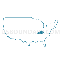
Outline
+PUMA%2c+Kentucky_A280.png)
Summary
| Unique Area Identifier | 192976 |
| Name | Bluegrass Area Development District (West) PUMA |
| State | Kentucky |
| Area (square miles) | 861.63 |
| Land Area (square miles) | 847.16 |
| Water Area (square miles) | 14.47 |
| % of Land Area | 98.32 |
| % of Water Area | 1.68 |
| Latitude of the Internal Point | 38.02015970 |
| Longtitude of the Internal Point | -84.86998360 |
Maps
+PUMA in Kentucky.png)
Graphs
Select a template below for downloading or customizing gragh for Bluegrass Area Development District (West) PUMA, Kentucky
+PUMA%2c+Kentucky_T0.png)
+PUMA%2c+Kentucky_T1.png)
+PUMA%2c+Kentucky_T2.png)
+PUMA%2c+Kentucky_T3.png)
+PUMA%2c+Kentucky_T4.png)
+PUMA%2c+Kentucky_T5.png)
+PUMA%2c+Kentucky_T6.png)
+PUMA%2c+Kentucky_T7.png)
+PUMA%2c+Kentucky.png)
Neighbors
Neighoring Public Use Microdata Area (by Name) Neighboring Public Use Microdata Area on the Map
- Bluegrass Area Development District (Central)--Lexington-Fayette County (Outer) PUMA, KY
- Bluegrass Area Development District (Northeast) PUMA, KY
- Bluegrass Area Development District (South) PUMA, KY
- KIPDA Area Development District (Northeast) PUMA, KY
- KIPDA Area Development District (Southeast) PUMA, KY
- Lincoln Trail Area Development District (East) PUMA, KY
- Northern Kentucky Area Development District (Southeast) PUMA, KY
Top 10 Neighboring County (by Population) Neighboring County on the Map
- Fayette County, KY (295,803)
- Franklin County, KY (49,285)
- Jessamine County, KY (48,586)
- Scott County, KY (47,173)
- Nelson County, KY (43,437)
- Shelby County, KY (42,074)
- Boyle County, KY (28,432)
- Woodford County, KY (24,939)
- Anderson County, KY (21,421)
- Mercer County, KY (21,331)
Top 10 Neighboring County Subdivision (by Population) Neighboring County Subdivision on the Map
- Frankfort CCD, Franklin County, KY (46,507)
- Lexington-Fayette Southwest CCD, Fayette County, KY (40,943)
- Georgetown CCD, Scott County, KY (38,069)
- Danville CCD, Boyle County, KY (20,296)
- Versailles CCD, Woodford County, KY (19,127)
- Lawrenceburg CCD, Anderson County, KY (17,187)
- Harrodsburg CCD, Mercer County, KY (13,653)
- Springfield CCD, Washington County, KY (8,950)
- Wilmore CCD, Jessamine County, KY (8,313)
- Stamping Ground CCD, Scott County, KY (6,153)
Top 10 Neighboring Place (by Population) Neighboring Place on the Map
- Lexington-Fayette urban county, KY (295,803)
- Frankfort city, KY (25,527)
- Lawrenceburg city, KY (10,505)
- Versailles city, KY (8,568)
- Harrodsburg city, KY (8,340)
- Midway city, KY (1,641)
- Burgin city, KY (965)
- Salvisa CDP, KY (420)
- High Bridge CDP, KY (242)
Top 10 Neighboring Unified School District (by Population) Neighboring Unified School District on the Map
- Fayette County School District, KY (295,803)
- Jessamine County School District, KY (48,586)
- Scott County School District, KY (47,173)
- Franklin County School District, KY (44,856)
- Shelby County School District, KY (42,074)
- Nelson County School District, KY (30,498)
- Woodford County School District, KY (24,939)
- Anderson County School District, KY (21,421)
- Mercer County School District, KY (18,592)
- Spencer County School District, KY (17,061)
Top 10 Neighboring State Legislative District Lower Chamber (by Population) Neighboring State Legislative District Lower Chamber on the Map
- State House District 62, KY (58,232)
- State House District 58, KY (55,670)
- State House District 50, KY (49,478)
- State House District 39, KY (49,138)
- State House District 47, KY (46,003)
- State House District 55, KY (45,145)
- State House District 36, KY (45,022)
- State House District 61, KY (44,092)
- State House District 56, KY (43,948)
- State House District 54, KY (40,149)
Top 10 Neighboring State Legislative District Upper Chamber (by Population) Neighboring State Legislative District Upper Chamber on the Map
- State Senate District 26, KY (134,003)
- State Senate District 17, KY (133,729)
- State Senate District 20, KY (133,454)
- State Senate District 7, KY (128,013)
- State Senate District 22, KY (126,095)
- State Senate District 14, KY (120,817)
- State Senate District 12, KY (115,570)
Top 10 Neighboring 111th Congressional District (by Population) Neighboring 111th Congressional District on the Map
- Congressional District 2, KY (760,032)
- Congressional District 6, KY (759,205)
- Congressional District 4, KY (741,464)
Top 10 Neighboring Census Tract (by Population) Neighboring Census Tract on the Map
- Census Tract 604, Jessamine County, KY (8,313)
- Census Tract 9501, Anderson County, KY (8,164)
- Census Tract 9701, Garrard County, KY (6,089)
- Census Tract 711, Franklin County, KY (6,056)
- Census Tract 701, Franklin County, KY (6,053)
- Census Tract 710, Franklin County, KY (5,957)
- Census Tract 9602, Mercer County, KY (5,809)
- Census Tract 802, Spencer County, KY (5,727)
- Census Tract 606, Jessamine County, KY (5,648)
- Census Tract 704.02, Franklin County, KY (5,643)
Top 10 Neighboring 5-Digit ZIP Code Tabulation Area (by Population) Neighboring 5-Digit ZIP Code Tabulation Area on the Map
- 40601, KY (49,566)
- 40324, KY (41,342)
- 40356, KY (40,503)
- 40511, KY (31,798)
- 40422, KY (24,280)
- 40383, KY (22,408)
- 40342, KY (21,125)
- 40330, KY (19,334)
- 40444, KY (14,096)
- 40513, KY (10,994)